Application of Building Information Modeling (BIM) / CrossRail & Transportation for London
Crossrail is a major design-build project to construct a new railway line across central London (UK). It includes 42km of track and 10 new underground stations. Project construction began in 2009. The project is being delivered by Crossrail Limited (CRL), currently a wholly owned subsidiary of Transport for London (TfL). Once the project is complete it will be operated by TfL as the Elizabeth Line. The Crossrail project provides a good example of the application of several BIM elements. Early on, CRL established the following objective:
To set a world-class standard in creating and managing data for constructing, operating and maintaining railways by:
- Exploiting the use of BIM by Crossrail, contractors and suppliers
- Adoption of Crossrail information into future infrastructure management (IM) and operator systems
CRL established a Common Data Environment (CDE) with integrated information about the project and the assets it includes. This environment included CAD models, separate linked databases containing asset details, GIS data, and specialized applications for scheduling, risk management and cost management. Data warehousing techniques were used to combine and display integrated information. Considerable work went into defining asset data requirements and setting up standard, well documented data structures and workflows to provide an orderly flow of information from design through construction, and on to maintenance and operation. It was essential to create a common information architecture given that work on each of Crossrail’s nine stations was conducted by different teams, each consisting of multiple contractors. Each station was comprised of over 15,000 individual assets.
Key elements of the approach included:
- A common asset information database with standard templates for deliverables. This database serves as the “master data source from which playlists of information can be created.”
- An asset breakdown structure (ABS) that relates facilities (e.g. stations) to functional units (e.g. retaining walls) to individual assets (e.g. steel piles).
- Asset naming, identification and labeling standards that distinguish functional duty requirements (e.g. a pump is needed here) from specific equipment in place fulfilling these requirements.
- Asset data dictionary definition documents (AD4s) that lay out the specific attributes to be associated with different types of assets, based on the ABS.
- Sourcing of the asset data from design and as-built information.
- A Project Information Handover Procedure specifying the methods of data and information handover for maintenance and operations once the construction has been completed.
- Use of a common projected coordinate system for CAD and GIS data
- Use of a federated data model in which information was maintained within separate special purpose systems, with a common master data model enabling sharing and interpretation of data from the different sources. The master model included elements such as time periods, budget and schedule versions, organizations, data owners, contractors, milestones and key events.
Sources:
https://learninglegacy.crossrail.co.uk/documents/building-a-spatial-infrastructure-for-crossrail/
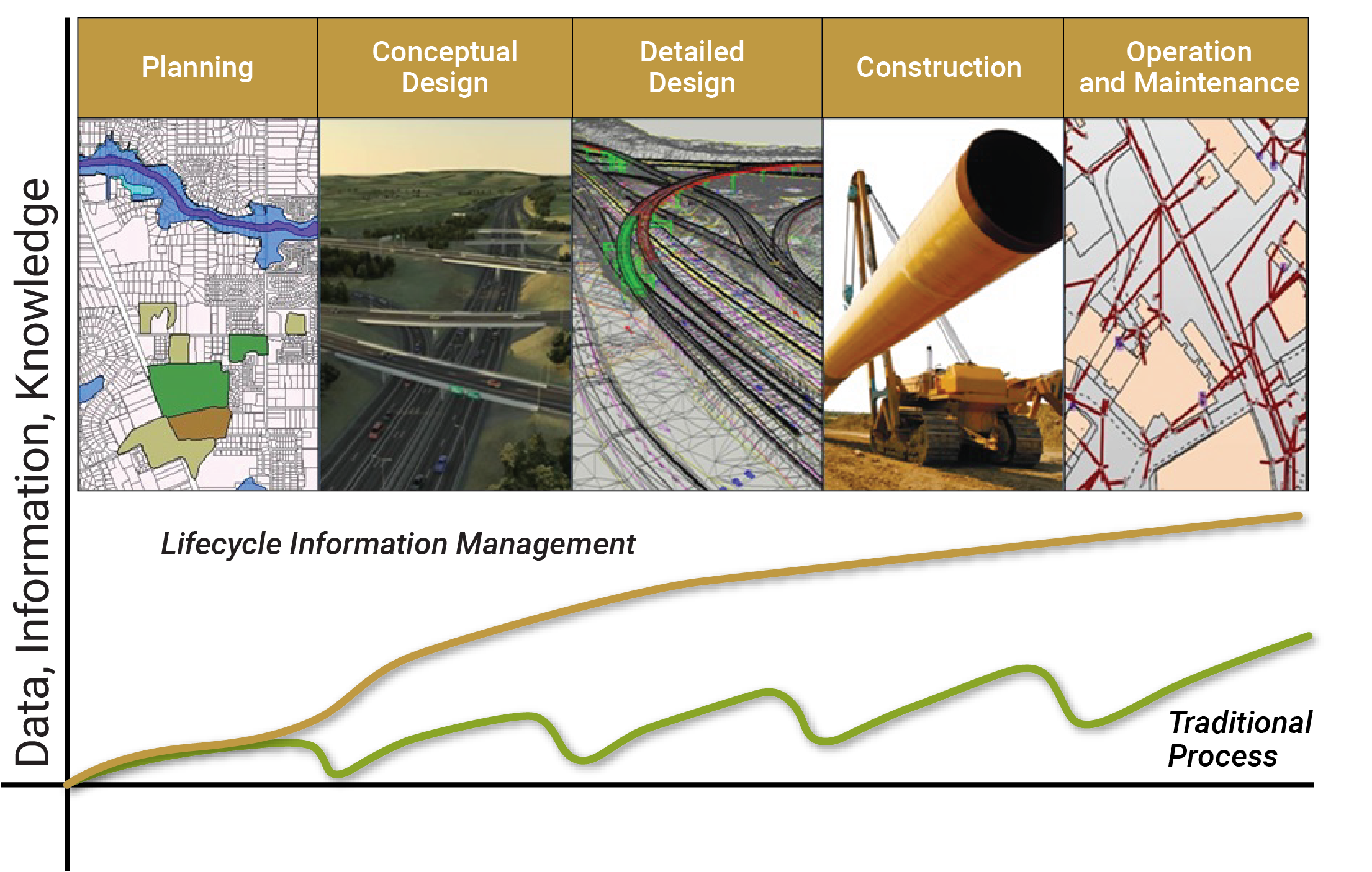
BIM Lifecycle Information Management
Source: Adapted from Crossrail. 2016. Building A Spatial Data Infrastructure For Crossrail. https://learninglegacy.crossrail.co.uk/documents/building-a-spatial-infrastructure-for-crossrail/
Read more in the chapter: 7.1.4 Integrating Asset Information Across the Life Cycle
